Mapping Landscapes to Support Science, Safety, & Stewardship
LiDAR mapping at Grand Canyon uses high-resolution data to support research, resource protection, and informed land management.

LiDAR (Light Detection and Ranging) is an advanced mapping technology that creates highly detailed, three-dimensional models of landscapes. At Grand Canyon National Park, LiDAR mapping gives scientists, land managers, and park staff a powerful way to understand terrain, environmental change, and resource conditions across an immense and complex landscape.
Every day, decisions are made that affect water resources, wildlife habitat, archaeological sites, public safety, and long-term land use. LiDAR provides the precise, high-resolution data needed to support those decisions, revealing subtle changes in the landscape and helping identify where protection or intervention is most urgently needed.
As the official nonprofit partner of Grand Canyon National Park, Grand Canyon Conservancy supports LiDAR mapping efforts that strengthen science-based planning, stewardship, and protection of the park’s natural and cultural resources. Donor support ensures that park staff and researchers have access to the tools and information needed to protect Grand Canyon today and for generations to come.
Help Advance LiDAR Mapping and Science-Driven Stewardship
Your generous gift will:
- Allow the collection of high-resolution LiDAR data for the remainder of Grand Canyon National Park—more than 1,200 square miles.
- Facilitate the development of data collection apps that can be used by park staff to log real-time change reports.
- Improve long-term environmental monitoring and change detection efforts, including those related to climate change, wildlife habitat, water quality, and archaeology.
Every contribution helps build the knowledge foundation needed to safeguard one of the world’s most extraordinary landscapes.
Support this Project
Donate Now
Fundraising Goal
$500,000
Project Partners
Grand Canyon National Park
Grand Canyon Conservancy
United States Geological Survey
Northern Arizona University
Why LiDAR Mapping Matters
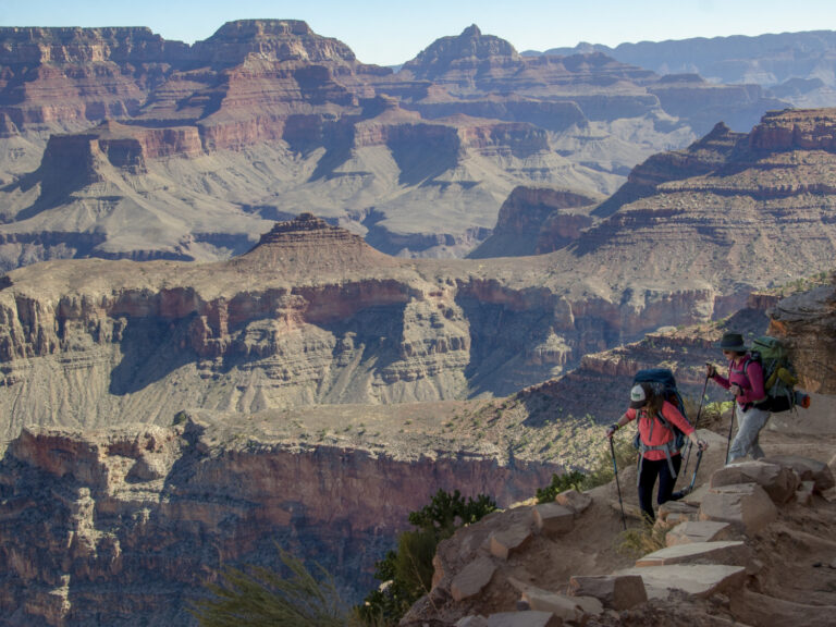
Grand Canyon’s vast size, rugged terrain, and layered geology make traditional mapping methods difficult, and in some areas impossible. LiDAR allows researchers to “see” the landscape with extraordinary clarity, even beneath vegetation.
LiDAR mapping supports:
- Detailed understanding of landforms, fault lines, and geological features
- Improved planning for conservation, restoration, and infrastructure projects
- Detection of subtle landscape changes related to erosion, climate change, and land use
- Enhanced protection of sensitive natural and cultural resources
- Data-driven decision-making that supports both stewardship and public safety
High-resolution mapping ensures that decisions affecting Grand Canyon are guided by accurate, comprehensive, and current information.
How LiDAR Technology Works
LiDAR uses laser pulses emitted from aircraft to measure distances between the sensor and the ground. Millions of measurements are collected and combined to create precise, three-dimensional models of the landscape.
This technology allows scientists and managers to:
- Map terrain beneath vegetation
- Analyze elevation, slope, and surface features
- Identify erosion patterns and landscape change
- Support research across disciplines, from hydrology to archaeology
LiDAR data can be revisited and reanalyzed over time, making it a critical tool for long-term monitoring and adaptive management.
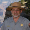
Ed Keable
Superintendent Grand Canyon National Park“Grand Canyon National Park already teaches us so much about life on this planet. Being able to have a full LiDAR view of the park would give us incredible insights on how best to protect and sustain this one-of-a-kind environment.”
What’s Been Completed
With support from Grand Canyon Conservancy, major progress has been made toward comprehensive LiDAR coverage across the park.
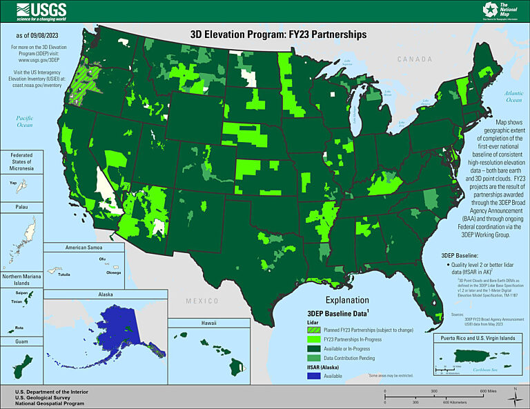
Most notably, GCC funding enabled an agreement with the U.S. Geological Survey to collect 1,281 square miles of high-resolution LiDAR data within Grand Canyon National Park. This data was acquired in August 2025, significantly expanding modern mapping coverage across the park.
Preliminary data has been received and is currently undergoing quality review. The newly collected dataset includes a 416-gigabyte raw LiDAR point cloud, providing an unprecedented level of detail for scientific analysis and land management applications.
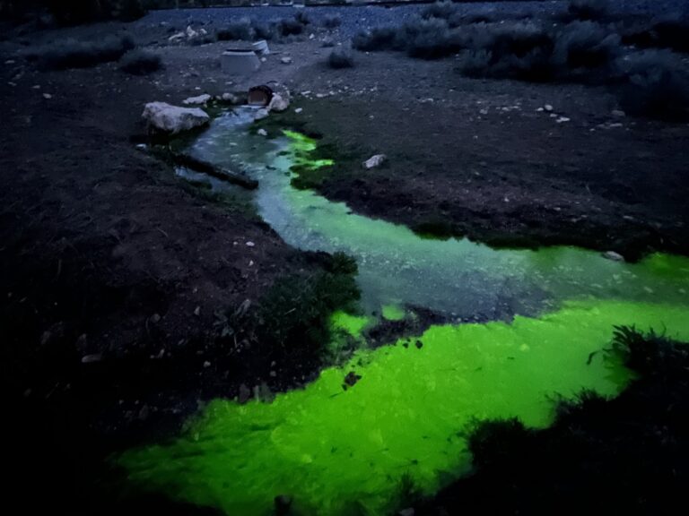
In addition to data collection, GCC funding supported expanded scientific research through a cooperative agreement with Northern Arizona University, funding a post-doctoral researcher focused on understanding Grand Canyon’s groundwater systems at a landscape scale. Using spatial modeling, the new LiDAR data will help identify potential groundwater flow paths, springs, and areas of shallow groundwater across the park.
This work also includes the development of data fusion products, combining LiDAR with multispectral satellite imagery and other datasets to create a more complete picture of how surface features, geology, and water systems interact.
Strengthening Data, Safety, and Park Operations
GCC funding also played a critical role in staffing the park’s Data Management and Analytics Program (DMAP) by supporting a dedicated GIS Specialist position.
Throughout the year, the GIS Specialist provided essential mapping, data support, and field assistance across park operations. One key contribution included helping the park’s dispatch center migrate to a new computer-aided dispatch system by developing accurate spatial layers such as patrol district boundaries and dispatch area polygons.
This marked the first time the mapping team supported this essential public safety service, demonstrating how LiDAR and GIS data directly contribute to both resource protection and visitor safety.
What’s Planned
LiDAR mapping will continue to play a vital role in future research and stewardship efforts at Grand Canyon.
Ongoing priorities include:
- Completing LiDAR coverage for remaining areas of the park
- Using updated data to monitor landscape change over time
- Expanding groundwater and ecosystem research using integrated datasets
- Supporting real-time data tools that allow park staff to document changes observed in the field
- Informing long-term planning, conservation strategies, and adaptive management
Together, these efforts help ensure that management decisions remain proactive, science-based, and responsive to a changing environment.
Frequently Asked Questions
What does LiDAR stand for?
LiDAR stands for Light Detection and Ranging, a technology that uses laser pulses to create detailed maps of the landscape.
Why is LiDAR useful at Grand Canyon?
LiDAR provides precise data across rugged terrain, helping scientists understand landforms and support conservation planning.
Is LiDAR data used beyond mapping?
Yes. LiDAR data supports geology, ecology, hydrology, cultural resource protection, and long-term monitoring.
How does LiDAR support conservation decisions?
Accurate mapping allows managers to plan projects, assess risks, and protect sensitive areas using reliable data.
Contact us to receive more information about this project.
GCC Philanthropy Team
Related Projects & Resources